
The United Nations just voted to promote a “new” world map that visually shrinks the United States while supersizing Africa — and America stood alone voting no.
Story Highlights
- The United Nations endorsed promoting the Equal Earth map by a 164–1 vote; the United States voted no.
- The resolution is nonbinding but urges schools and institutions to prefer equal-area maps over Mercator.
- Togo led the push on behalf of African states, with African Union backing.
- U.S. officials called the measure ideological and a distraction from real global problems.
What The United Nations Approved And What It Does Not Do
The United Nations General Assembly approved a resolution that promotes the Equal Earth map projection for education and public use. The vote was 164 in favor, one against, and six abstentions, with the United States as the sole “no.” Reports say the text urges a shift away from treating the Mercator map as default, arguing Equal Earth better represents land areas, especially Africa. The measure is not a law. It is nonbinding and does not ban Mercator or force compliance.
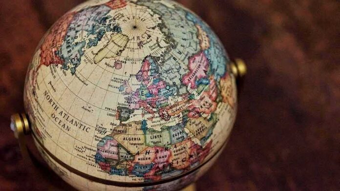
Coverage of the resolution says it describes Equal Earth as “a relevant option” to improve accuracy in how the world’s regions appear on maps. Supporters say traditional Mercator maps make places near the poles look far larger than they are, while areas near the equator, like Africa, look smaller. That distortion is real on world maps, even though Mercator remains useful for navigation because it preserves angles and bearings for routes.
Who Pushed The Change And Why Africa Is Center Stage
Togo led the effort on behalf of African states, and the African Union supported the push. Backers argued that maps shape how people see power and place, and that a fairer area-based map helps correct long-standing visual bias. The case focused on classroom use, textbooks, and public displays, not on shipping charts or flight planning. Supporters framed Equal Earth as a way to “rebalance” representation by showing Africa’s true scale relative to North America and Europe.
Media summaries say the resolution highlights the gap between what people think they see on Mercator and what the numbers show. Africa’s land area tops 30 million square kilometers, yet common Mercator wall maps make Greenland and parts of northern countries look comparable or larger. Equal Earth keeps relative areas right, so equatorial regions do not get minimized on the page. This clarifies size, though no projection can keep every shape and distance perfect.
Why The United States Voted No And What It Means
United States officials said the measure was ideological and a distraction from urgent work on peace, prosperity, and stability. Ahead of the vote, American representatives warned that tying map choices to concepts like “cognitive justice” turns a technical topic into activism and erodes trust in the institution. They argued the United Nations should stay focused on real-world security and economic problems, not symbolic fights over which flat map sits in a classroom.
For American families, the risk is mission creep. A nonbinding vote can still pressure schools, publishers, and platforms to change materials. That could swap out tools people know without a clear gain for daily life. The United States stood alone to make a point: do not let elite bodies use soft power to steer culture and curriculum by decree. Parents, teachers, and local boards should decide what maps they use, not distant bureaucrats.
What Changes Next In Classrooms, Media, And Software
Because the resolution is advisory, adoption depends on education ministries, publishers, and software companies. Some will move fast to please the United Nations and the African Union. Others will keep Mercator for certain tasks, since it helps with navigation and some digital use cases. Expect a patchwork. Textbook updates, museum displays, and news graphics may lean toward Equal Earth, while technical fields keep tools that fit their work best.
Practical guidance from cartography groups already notes that Mercator distorts area at world scale and should not be the default for global displays. Those guides also stress choosing the right tool for the job. Equal Earth fixes area size but bends shapes and lines in other ways. The smartest path is choice by purpose, not politics. Local control protects that common-sense balance better than any sweeping, symbolic vote from New York.
Bottom Line For U.S. Readers
The United Nations endorsed promoting Equal Earth maps, not enforcing them. Africa will look larger, and the United States and Europe will look smaller on many new wall maps and graphics. The United States voted no to defend focus, standards, and local control. Parents and school boards should watch for change in curricula and ask a simple question: does this map help students learn truth, or is it another top-down push wrapped in feel-good words?
Sources:
newscord.org, english.aawsat.com, ctvnews.ca